


Goat Mountain is located in Landers California, a small desert town to the north of Joshua Tree National Park. This desolate trail is off the beaten path, far from the expansive National Park or any nearby mountains. Hike up this quiet mountain past old gold mining shafts to an epic view of the Mojave Desert.
Tip: Make sure you bring good hiking boots, Danner makes some with vibram soles that have great traction. These Boot Trail 2650 are nice looking and fuctional.
To Get There
- Trailhead location: 34.29153, -116.3717
- Loop Trail Hike: around 3.5 miles out and back
- Rated: Moderate
- Elevation change: approximately 1000 ft
When To Go
The best time to visit Landers, CA, is in spring (March to May) or fall (September to November), when daytime temperatures are mild, ranging from 70–85°F, and the desert blooms with wildflowers. Avoid summer, as temperatures often exceed 100°F, making outdoor activities less enjoyable.
The History of Goat Mountain
Landers, California, was established in 1914 by miners drawn to the promise of gold at Goat Mountain. Legend has it that a man named Charlie Reche stumbled upon the mountain while returning from a deer hunt. Seeking shelter from the cold, he hugged the mountain’s edge and discovered a glint of gold. This chance finding prompted him to start mining the area, leading him to relocate his family to Landers. Reche worked the mountain diligently from 1914 until 1932, at which point he sold it.
The mountain later came into the possession of a man named Helfer, who initially arrived in Landers searching for a different mine. Helfer mined Goat Mountain for a time before eventually relinquishing it. Today, the Bureau of Land Management oversees the mountain, preserving its storied history for future generations (Source: Morongo Basin Historical Society).


The Hike: Goat Mountain
When you get to the end of the road, there are a few hard to see signs that point you to the trail. Park at the bottom of the hill close to someone’s private property, with a tall chain-linked fence around it. There isn’t a parking lot or a side road, just a wash of hard-packed sand. You can’t see the trailhead, but you can see where the road has been cut into the mountain. Walk up the hill to towards the mountain and then you can easily see where the trail takes you. Start the hike by walking up and to the right.
Goat Mountain was a tough trail to find online, it’s not on any hiking sites, which is surprising because there are a lot of interesting sights and views along the way. We mapped ourselves to Goat Mountain Road in Landers and followed the GPS to the mountain’s edge (coordinates of trailhead above).
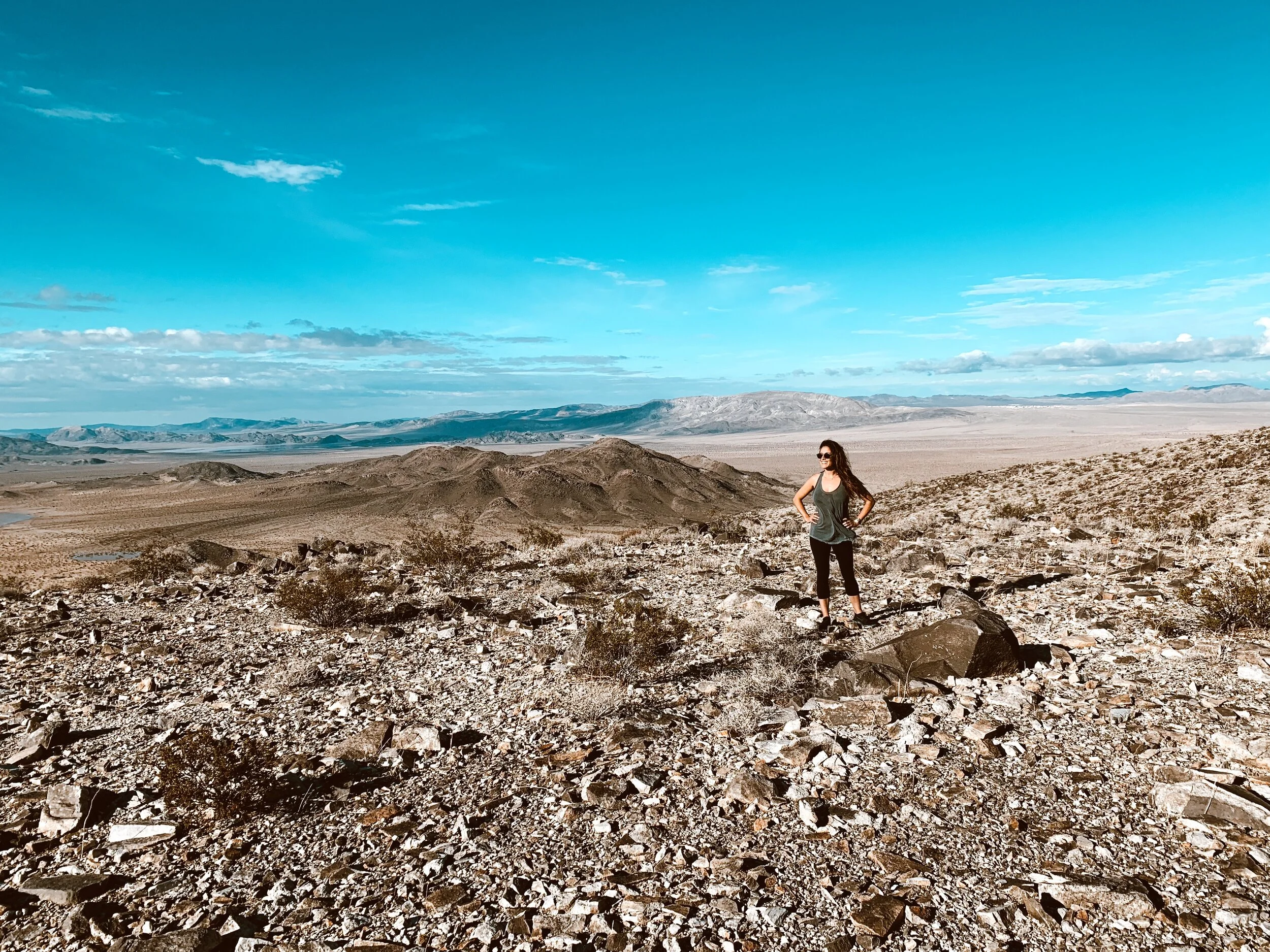
The climb to the top of the mountain is easy to follow once you find the start (see coordinates above). The path is a disheveled mess of rocks etched into the side of this 640 acre mountain. The mountain is a lone protrusion rising up out of the dirt of Landers. As you climb up, there are views of desert rivers washes and endless mountains in the distance. If you’re lucky clouds will fill the sky and paint it the colors of the rainbow. We felt like steadfast adventurers, alone in on the trail, smelling the dry earthy air, not a soul in sight.

The remains of old mines shafts scar the mountain with abandoned dreams of wealth and riches. You can imagine heading into the cold, dark tunnels in search of gold. Most of the shafts have been filled in over time, either for safety or simply rocks falling in over the last many decades. In the image below you can see there’s a rusty old mine cart, a little piece of history peeking up from the surface. Keep your eyes peeled for these time stamped relics along the hike.
Tips: This hike is full of loose rocks so watch those ankles!
Beware of crawling into mine shafts, they can collapse at any given point.


When you reach the top of the mountain, there is an incredible 360 view of the expansive Mojave Desert. Grids of homestead lands to the south where people live in Landers and Joshua Tree, and sand and rolling mountains to the north. On one of the days we did this hike, the cold wind whipped across the exposed summit chilling us to the bone. On other days it’s too hot to even attempt.



If you climb a little higher past the plateau and a little off trail you’ll find a creative sun dial someone created from rocks.

You can see the Integratron’s white dome from here, where people flock to experience immersive sound baths.


Goat Mountain hike is really beautiful, has an interesting history, and it’s off the beaten path so you will most likely have the trail all to yourself. If you’re visiting Joshua Tree and have been into the park several times, check out this trail instead and you won’t be disappointed.
I hope this helps you plan your trip! Do you have any more insights on things to do Landers? Please leave them in the comments below. Are you going to visit Joshua Tree National Park? Check out all my blog posts about it, my parents have lived in the desert over 10 years now and we’ve explored all over!
Hiking Gear
Here are a few of my favorite brands and picks for hiking apparel and gear.

Book Your Trip
These are some of my favorite sites for finding the best prices, places to stay, book tours, and more:
Book Your Accommodations
Use Booking.com for the best hotel deals and easy change or cancellation
Find A Tour
Search Get Your Guide to book a variety of tours and activities
Book Your Flight
Browse Expedia for deals on flights, hotels, rental cars and more
Shop Comfortable Hiking & Athleisure
Shop Vuori for long-lasting comfortable hiking and workout apparel for men and women (my fave!)
Shop Travel Gear
Shop Herschel for nice luggage and other travel goods and accessories that are made to last
This website contains some affiliate links. If you purchase an item, I receive a small commission at no added cost to you. Thank you for supporting this travel blog with your purchase!
Like This Post? Pin It.


13 Responses
You know what’s up! Thanks for the info.
Thanks D!
can you still find crystals on goat mountain??
I’m not sure Kat. I tried looking into it but there isn’t much information. You should ask this person who does a lot of digging. I found them on instagram.
https://www.instagram.com/idigcalifornia/
I’m not sure Kat.
When I was growing up this was called Seven Goat and it was Landers Corners.
Oh really? Thank you for sharing, those are such interesting historical facts!
Thanks for the trail info!! I just bought a piece of property nearby and am looking forward to hiking there soon!
That’s great! I hope you enjoy both Landers and the trail. I love the desert!
Your photos of looking south and north are the same one. Thanks for the info, I was looking for any info on the mountain, while in the area
Oops, you’re right. I’ll remove one, looks like those are the south facing because there are structures on the south side.
Hi Chrissi,
I’m an author currently writing a young adult fiction adventure series titled The ARGO Files: Team Philotimo. In the story, my protagonists—four kids and their high-tech robot dog—climb Goat Mountain to conduct some drone reconnaissance on a massive AI Data Center to the East.
The reason I’m reaching out is that I’m incorporating “Learning Links” into the book via QR codes. I want my readers to be able to see what the real Goat Mountain looks like, and your blog post captures the terrain perfectly. I especially love the photo of you near the summit area; it looks exactly like the spot where, in my story, a character falls into an old mine shaft and requires wilderness first aid.
I’m a fellow desert enthusiast—I have a 10-acre retreat near the Integratron—so I’m very passionate about getting the local details right.
Would you be open to me linking to your blog post in my book? It would be a wonderful way for kids to see the actual landscape behind the adventure.
The website link below is for my daughter, only because a link was requred.
Best regards – Phil
Hi Phil, I would love that! I have a random pdf I found about the site from the Morongo Basin Historical Society if you’d like to see it.